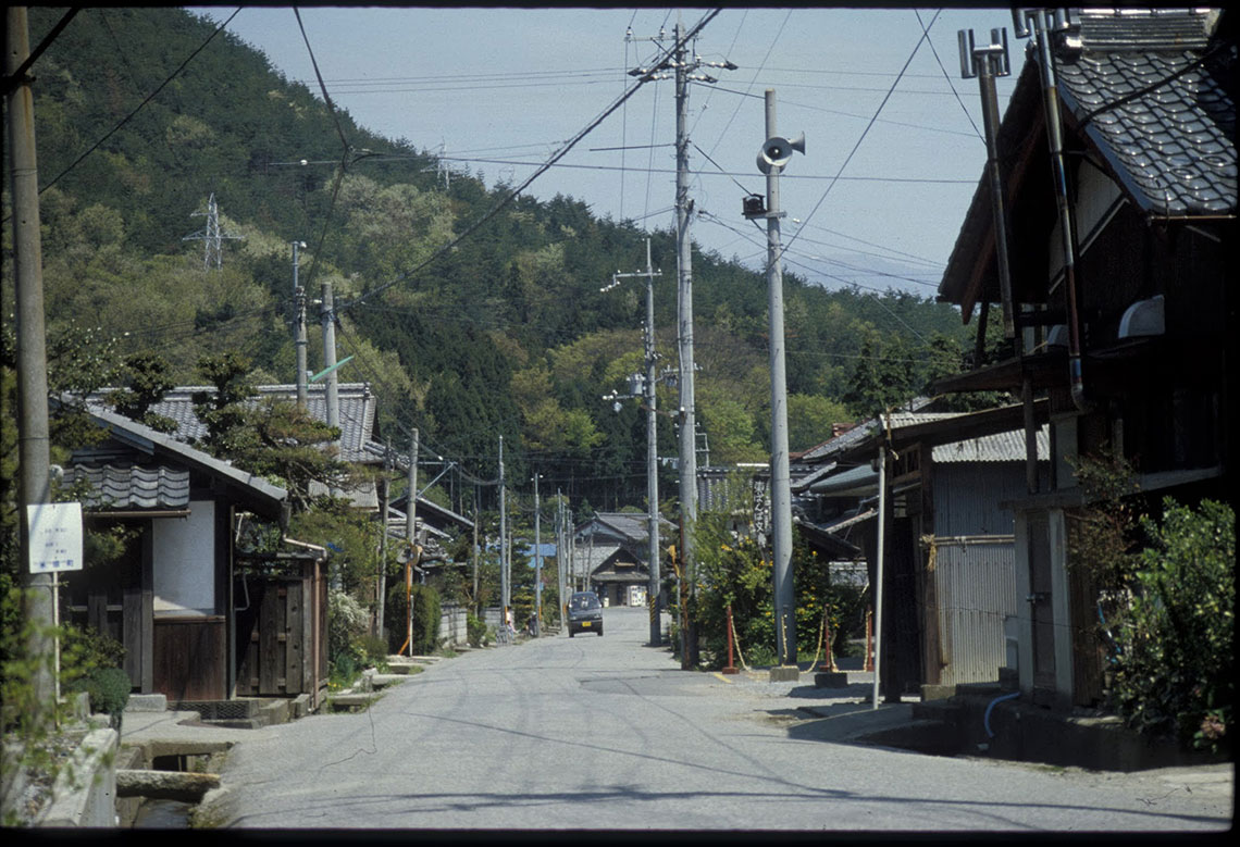
Apart from the distant roar of the Meishin Expressway the former post-town of Bamba is now a quiet agricultural community set in a lush green valley surrounded by forest, bamboo groves, and rice fields. No inns survive today of the ten that were recorded in 1843, but the layout of the town still resembles that of the late Edo period. Essentially Bamba is divided into two halves. The original post-town is in the upper part of the valley, nearest Kyoto. Lower down is a later extension to the town, at the junction with the road to Maibara – a few miles away on the shores of Lake Biwa. This road offered a popular alternative route to travelers who, from the late Edo period, could take a boat across the lake between Otsu and Maibara.

Leaving the valley, where the old highway is lined once more by namiki, the Nakasendo is joined again by the modern highway (now Route 17) as all routes begin to converge on the pass at Sekigahara. Settlements here are also more numerous, including three post-towns along the eleven mile stretch from Bamba to Sekigahara. The first of these is Samegai, just two and a half miles from Bamba. This town was relatively small, with a population of 540 in 1843 and just eleven inns. It is still characterized by attractive waterways which flow along the main street and it is these which explain the main role of Samegai as a post-town in the past. Unusually the town had as many as seven tonya (the official transport managers and general merchants), whereas most post-towns only had one or two. The reason for this disproportionate number is that the waterways, although small, could be used for the transport of essential goods and supplies. These were brought directly from the port at Maibara for transfer, at Samegai, to pack-horses and other means of transport.

Passing through more built up areas and, briefly, along a stretch of the modern highway, the Nakasendo now crosses the rice fields to the northern, more peaceful side of the valley. Nestled against the hill slopes of Mount Ibuki, some three and a half miles from Samegai, is the next post-town of Kashiwabara. Far removed from the roar of modern traffic this unassuming town offers welcome rest under the protective eaves of the few surviving, but now derelict former Edo period inns. For foot-weary, and perhaps infirm travelers of the past comfort might have been taken from the local manufacture of moxa, extracted from the leaves of plants which grow on Mount Ibuki.
A short way after leaving Kashiwabara an old stone obelisk stands next to the road, on the right hand side. This is the boundary post between the old provinces of Omi (Shiga prefecture) and Mino (Gifu prefecture), and it features in Hiroshige’s print of the next post-town, Imasu. Only two and a half miles from Kashiwabara, Imasu was another relatively small town whose function, along with the other post-towns of this valley, was to ensure a safe haven was available to travelers who might be caught in the heavy snows around Mount Ibuki in the winter months. The summit of Mount Ibuki is on record as having one of the highest amounts of accumulated snow in one year, anywhere in the world. Today this stretch of the old highway is one of the only sections of the Nakasendo to be protected by a piped water system, the water being pumped through holes along the center of the road to melt the snow as it falls.
Leaving Imasu the road ascends the narrow defile which guards the entry into Sekigahara and, beyond that, the Mino plain. The strategic importance of this site is fully appreciated as all the major east-west transportation routes converge on this low-lying pass. They include the old Nakasendo as well as the modern national highway and the Meishin Expressway. The roar of trains as they emerge from tunnels on either side of the road is also evident, slightly subdued for the local trains on the Tokaido trunk line on one side, and much louder for Shinkansen, or ‘bullet’ trains, on the oter.

low-lying pass
Approaching Sekigahara post-town, just two an a half miles from Imasu, is the site of Fuwa-no-seki, the 7th century barrier station from which Sekigahara (lit. ‘barrier on the moor’) derives its name.
Other pages of related interest:


